Drone Solutions for Mining and Exploration
Supporting small claim holders and major mining companies across British Columbia
Our Mining and Exploration Work
Airrays has supported both small claim holders and major mining companies across British Columbia with advanced drone services. Our work includes LiDAR scanning, high resolution aerial imagery, terrain modeling, and thermal imaging. These tools support field teams with accurate visual data for planning, monitoring, and decision making.
We help engineering, geology, and GIS teams understand the land, plan drill targets, lay out access roads, and track progress across remote and active mine sites. From dense forest to alpine rock, we access sites using ATVs, helicopters, or whatever it takes to deliver reliable data in real-world conditions.
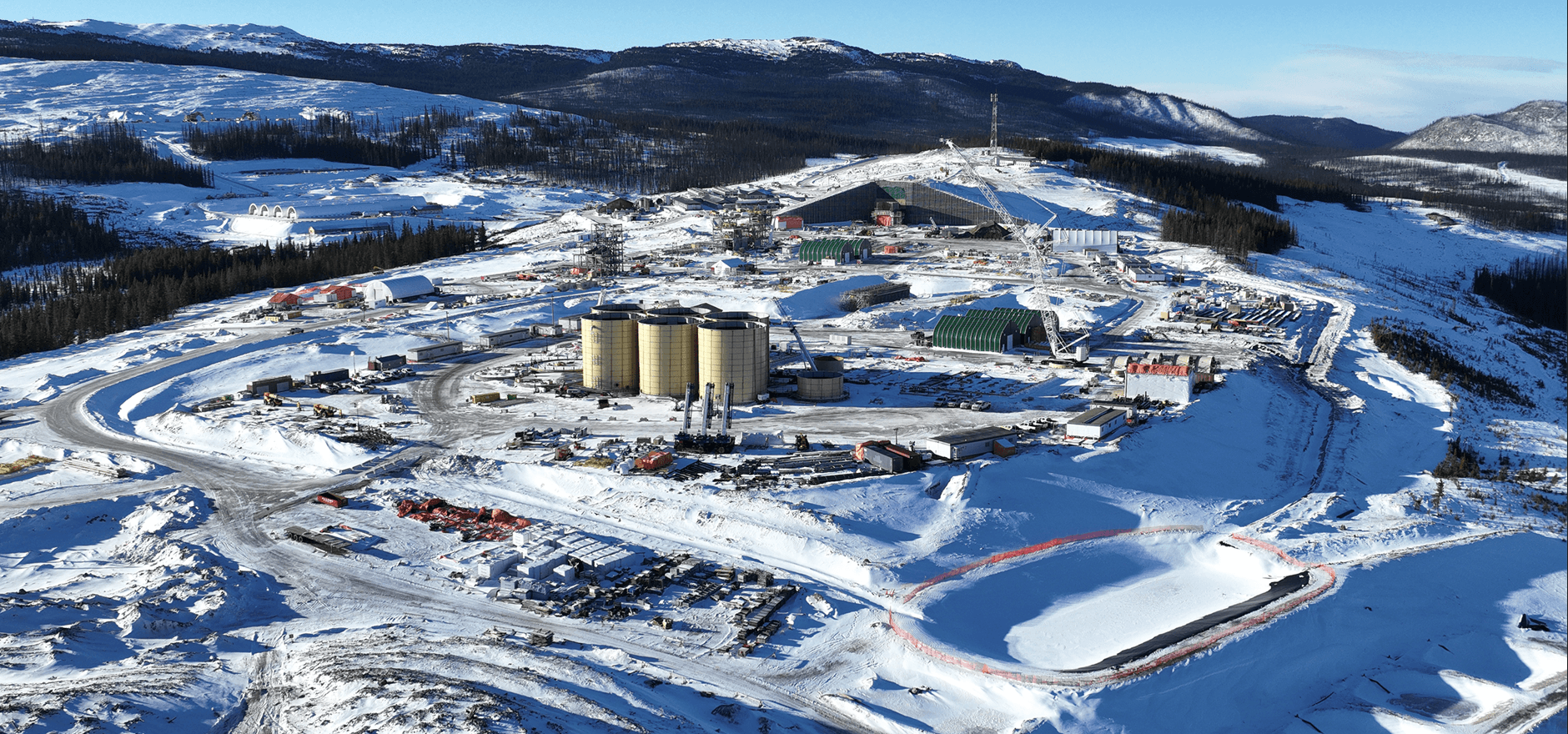
Blackwater Gold Mine Project
One of our most involved projects was with the Blackwater Gold Mine. Over a two year period, we completed regular drone flights to capture high resolution aerial imagery of the plant site and surrounding work zones.
This ongoing visual record helped project managers monitor buildout from land clearing through full plant completion. We supported inventory awareness, road layout documentation, and timeline coordination with consistent overhead imagery.
That kind of long term involvement and reliability is where we do our best work.
Deliverables We Provide Across Mining Projects
All deliverables are built to match the project's requirements and your team's software environment. Whether it is initial site mapping or progress monitoring, we ensure compatibility and accuracy.
High resolution orthomosaics with 1 cm ground sampling distance (GSD)
Accurate LiDAR point clouds (LAS, LAZ) and bare earth models
1 metre contours and DSM or DTM surface models
Thermal imagery to identify water, terrain risk, and heat signatures
Processed or raw outputs for CAD, GIS, and planning tools
We can also fly without ground control and deliver RTK or PPK data when needed, achieving consistent centimetre-level accuracy across complex terrain.
Our Technical Approach
We work directly with engineers, surveyors, planners, and GIS professionals to deliver results that fit seamlessly into your workflow. Our flights are designed for maximum coverage, accuracy, and repeatability.
Flight Planning
- Ground control points when required
- RTK and PPK positioning systems
- Optimized flight patterns for coverage
- Minimized error and overlap strategies
Export Formats
- GeoTIFF orthomosaics
- DXF for CAD tools
- SHP for GIS platforms
- LAS and LAZ point cloud data
Whether we are based out of a camp or flown in by helicopter, we deliver data your team can trust and actually use.