Precision Drone Services for Industry & Remote Work in Northern B.C.
We are more than a flying camera
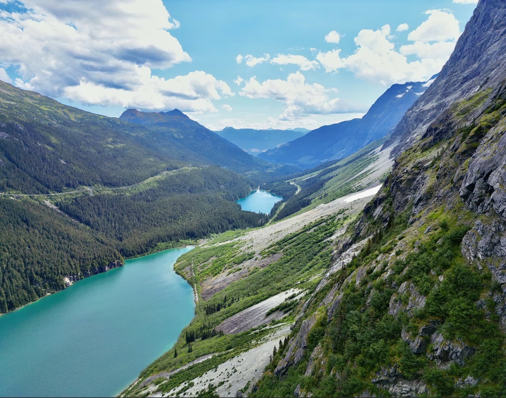
Airrays delivers high-accuracy aerial solutions for mine exploration, forestry, and industrial projects across Northern British Columbia. LiDAR, thermal imaging, RTK and PPK mapping, 3D modeling, stockpile volume reporting, and Avenza-ready maps. We also support inspections, environmental monitoring, and search and rescue with the same attention to detail.
British Columbia's premier choice for industrial drone and mapping solutions.
Problem Solvers First
Understanding Your Challenge
We do more than fly drones. We solve operational problems with data-driven solutions. Every project starts by learning what you truly need, not just what you think you need. We ask the right questions, listen carefully, and work alongside your team to define the real challenge before we fly.
Our Approach
We begin by listening. What challenge are you facing? What decisions will this data support? Knowing your goals shapes everything we do.
Why It Matters
Solving the right problem starts with asking the right questions. When we understand your challenges clearly, we deliver results that move your project forward.
Who Benefits?
Any client who wants a trusted partner, not just a vendor. We work with you to find the best path forward and support every stage of the process.
Custom Matched Solutions
Right Tools and Experience for the Job
Every job site is different, and we match our equipment and approach to fit. Whether it's a quick inspection or a large scale project in challenging terrain, we bring the right tools and knowledge to get it done. Our fleet includes LiDAR, thermal, and high resolution imaging systems, backed by RTK and PPK workflows for accurate mapping. We're equipped for remote work with full camp support, and we know how to operate safely in real field conditions, not just from a desk.
Our Fleet
We use a versatile group of enterprise drones, ranging from compact inspection aircraft to heavy lift platforms carrying advanced sensors. Each system is selected based on your project's terrain, size, and data needs. When required, we incorporate ground control points to ensure centimeter level accuracy with RTK or PPK workflows.
Fully Equipped & Experienced
We bring more than just drones. With decades of backcountry experience and the equipment to match, we're ready for remote and rugged projects. Our fleet is supported by ATVs, snowmobiles, and full camp gear for extended field work in hard to reach areas. We are Transport Canada certified with an Advanced Operations drone license and carry five million in liability coverage, so you can count on professional, safe, and compliant operations every time.
Who Benefits?
We support clients of all sizes, from property owners who need clear aerial data to engineering teams managing large forested or industrial areas. Our process scales to fit the job, and we deliver results built for real use in the field.
Comprehensive Post Processing
Deliverables
We deliver more than data. From 3D terrain models to field-ready orthomosaics, every output is tailored to your specific goals. Our mapping and modeling services support everything from mining and forestry to environmental monitoring. Whether you're planning a site, tracking changes over time, or making operational decisions, we deliver the tools to move forward with confidence.
Outputs
Orthomosaics, point clouds, 3D models, surface models, contour lines, volumetric analysis, cut and fill reports, thermal imaging, monthly progression updates, damage assessments, and Avenza-ready georeferenced maps.
Access
All deliverables are delivered in professional formats including GeoTIFF, LAS, DXF, PDF, and more. Data is structured for seamless use in CAD, GIS, and mapping platforms.
Who Benefits?
Surveyors, project managers, mining teams, forestry planners, environmental consultants, insurers, and emergency response coordinators.
Drone Services That Make a Measurable Impact
Real-World Applications
From emergency response to multi-year mining documentation, we bring reliable drone solutions to real-world problems. Whether it's forestry planning or tracking inventory over time, we deliver results that help industries move forward with confidence.
Use in the Field
Our drones support SAR operations, environmental monitoring, wildfire planning, and industrial inspections in remote or high-risk areas. From flight to post-processing, every step is built for reliability.
Progress You Can See
We capture ongoing site progress for mining and forestry clients. With repeatable flights and precise overlays, you can track change over months or years.
Who Benefits?
Teams who need dependable results in real environments, emergency responders, forestry planners, mine managers, consultants, and decision-makers who rely on visual data.
Services
Mapping & Surveying
Accurate, Georeferenced, Ready to Use
We deliver high-accuracy aerial mapping with LiDAR, RTK photogrammetry, and PPK workflows. Our maps support mine planning, forestry, and environmental surveys. From orthomosaics to contours, we provide GIS-ready data built for real decisions.


Our Approach
We use RTK and PPK workflows, verified with ground control points when required. Flights are planned for coverage, accuracy, and efficiency.
What You Get
Orthomosaics, bare earth models, 3D terrain, contours, DEMs, and deliverables compatible with CAD, GIS, and Avenza Maps.
Who Benefits
Engineers, mine planners, forestry consultants, road builders, and environmental professionals needing reliable mapping.
Volume Calculations
Precise, Rapid, Enterprise-Grade
Skip the tape measures and surveying crews. Our drone-based volume calculations deliver cubic meter accuracy in hours, not days. Perfect for stockpile inventories, excavation progress tracking, and material management across mining and aggregate industries.
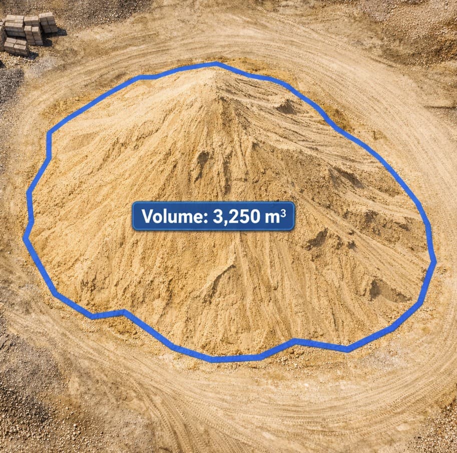
Faster Turnaround
Flight to final report in 24 hours. No site shutdown, no ground crews, no disruption to operations. Real-time data means real-time decisions.
Superior Accuracy
Centimetre-level precision using RTK positioning and dense point clouds. Verified against ground control for enterprise confidence. Direct integration with your inventory systems.
Safer Operations
Eliminate manual climbing, surveying crews working at heights, and equipment downtime. Drones handle unstable terrain and hazardous conditions your team cannot.
See What's Invisible
Thermal Imaging & Aerial Heat Monitoring
Reliable Thermal From Above
We deliver high-quality thermal data for inspections, monitoring, and emergency support. Whether you're scanning rooftops for heat loss, detecting hot spots in stockpiles, or supporting wildfire and SAR operations, we fly thermal with purpose and accuracy.
Emergency Response
Rapid thermal deployment for wildfire detection, search and rescue, and incident assessment. Real-time heat signature mapping supports critical decision-making.
Industrial Inspections
Identify equipment failures, heat loss, and anomalies across roofing, electrical systems, and process equipment without shutdowns or ground access risk.
Precise Data
Radiometric thermal video georeferenced to your exact site coordinates. Data exports for analysis and integration with your monitoring systems.
Safe, Efficient, and High-Res Detail From the Air
Drone Inspection Services
We provide high-resolution aerial inspections for hard-to-reach structures and infrastructure. Drones allow safer, faster, and more cost-effective checks for towers, rooftops, stockpiles, bridges, and more without shutting down operations.
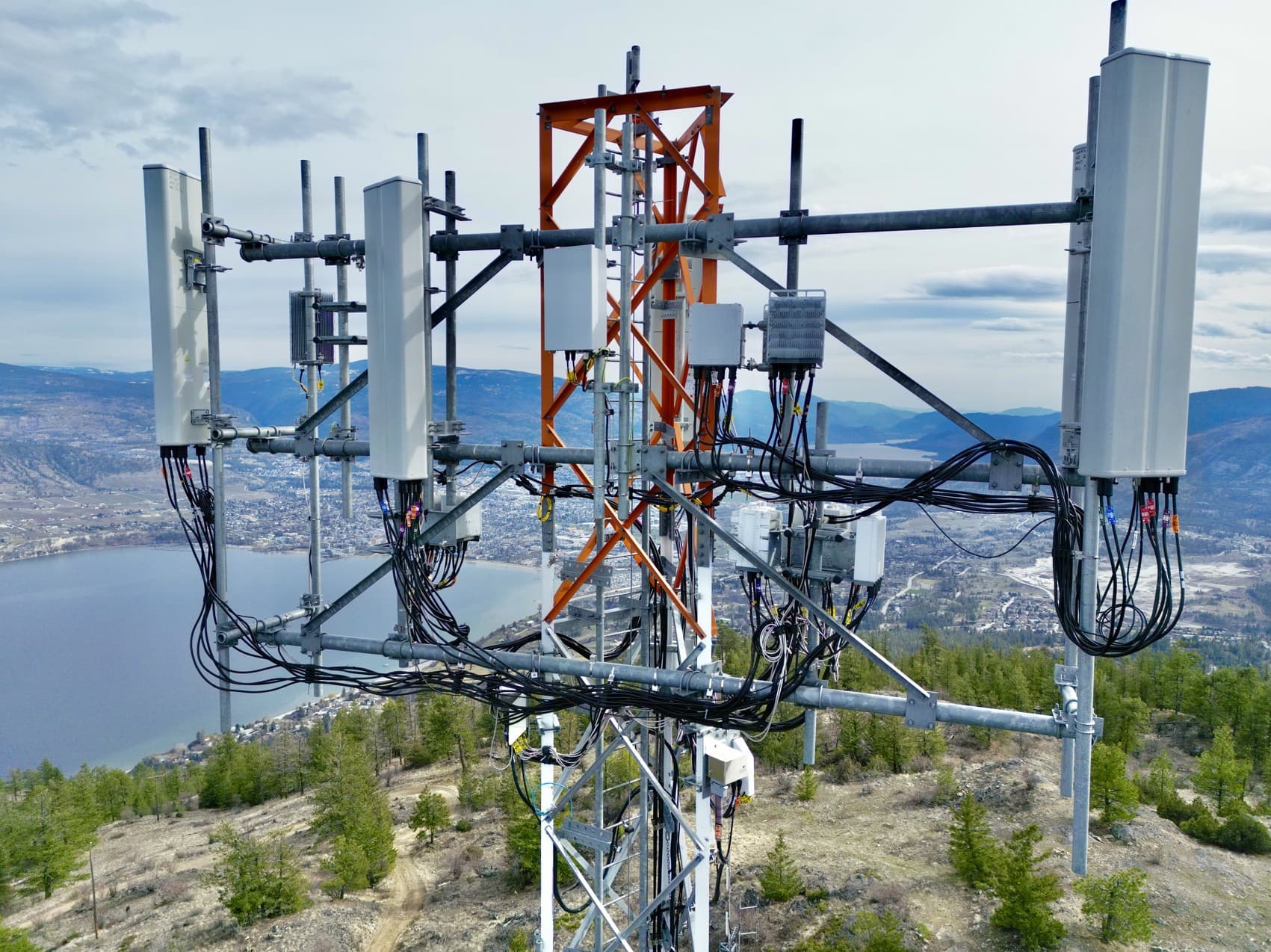
Our Approach
Flights are carefully planned with zoom optics, safety considerations, and mission-specific capture angles. We deliver visual and thermal data for structural review and documentation.
What You Get
High-resolution images and videos, thermal overlays, visual condition reports, and optional side-by-side comparisons over time.
Who Benefits
Mill operators, cell tower contractors, municipalities, engineering teams, insurance providers, and property owners needing fast, visual insights.
Drones Have Endless Applications — Let's Talk About Yours
Other Use Cases & Custom Solutions
Not every drone job fits into a box. From shoreline mapping and wildfire support to environmental surveys and line-of-sight checks, we've handled all kinds of work. We're always open to new challenges, ideas, and one-off solutions.
Get Free QuoteStrength in Numbers
With Every Flight, Airrays Delivers
500+
Projects Completed
Successful drone operations across Northern BC for diverse industries.
15K+
Hectares Surveyed
Comprehensive aerial mapping coverage for forestry and mining sectors.
48hr
Typical Turnaround
Fast delivery of processed data and deliverables to keep your projects on schedule.
Trusted By Industry Leaders


Get Your Free Project Quote
Tell us about your project and we'll provide a free quote or assessment. No obligation—just straight answers on timeline, deliverables, and how we can help.